
The 6 Best Hikes in the French Alps
There’s a reason why hikers and trail runners from all over the world descend on the French Alps. As the birthplace of mountain tourism, there is no better spot to discover over 200km of paths and trails with some of the most breathtaking views that can’t be put into words. Think unspoiled nature in the form of mountain peaks and turquoise blue lakes, contrasted against miles and miles of alpine meadows.
It’s also home to one of the most prestigious and challenging trail running events globally – the Ultra-Trail du Mont-Blanc (UTMB), when 10,000 runners arrive in Chamonix to take on the 176km-long and 10,000+ metres of elevation feat.
But you don’t have to be an Ultra Marathon-er to enjoy the trails that the Alps have to offer. There’s something for everyone, from flat, easy hikes, to challenging high-altitude trails. There’s even multi-day trekking experiences if you want to fully immerse yourself in mountain culture.
In this article, we’ll share our pick of the best hikes in the French Alps, from the iconic must-do bucket-list routes, to quieter trails perfect for a slower-paced day in the mountains. Whether you’re considering – or simply dreaming of – a French Alps hiking holiday, or just want to experience some incredible hikes, these French Alps hiking routes are worth a save on your Google Maps.
But, before you put on your hiking boots and head for the trails, here’s a few words of advice for hiking in the Alps:

What to Know Before You Hike in the French Alps
1. Respect the Altitude
One thing that sets French Alps hikes apart from other hiking destinations is the altitude. Even relatively “easy” trails can feel harder when you’re higher above sea level. You’ll likely notice your breathing becomes more shallow and your muscles fatigue faster than they would on flat terrain.
Start slower than you think you need to, and pace yourself on climbs – you know what is comfortable for you, so stay within a zone that feels manageable. It goes without saying to also take plenty of hydration breaks. Hiking at altitude will feel different to a regular day hike, because when you add in the elevation, altitude and sometimes more difficult terrain, you’ll be expending more energy over a longer period of time. Try to remember that hiking holidays shouldn’t be about rushing from summit to summit, but rather to take your time and enjoy the views.
2. Make a Plan
The Alps can be wonderfully wild, which is all part of the charm, but it also means planning is absolutely essential. Always map out your route in advance, check the weather and trail conditions, and let someone know where you're going, even for a short day hike. Having a plan makes your hike safer and more enjoyable, particularly if you’re an experienced hiker and plan to venture off the main tourist trails.
In terms of when to visit, the best time for hiking in the French Alps is between June and September when the trails are mostly snow-free, refuges and refreshment cafes along the trails are open, and the alpine meadows are at their very best.
If it’s your first time, or you simply prefer someone else to take care of the planning, it might be worth using a guide. Nuyama, as an example, are a team of outdoor lovers who know the trails inside out, so they will plan a route and guide you based on your requirements and abilities.
3. Check the Weather (More Than Once)
Alps weather can change in a heartbeat, and being prepared is a big part of a successful French Alps hiking experience. You can be greeted with bluebird skies in the morning, only for afternoon storms to replace them, particularly in the summer.
Be sure to always check the forecast before you set off, but keep in mind that conditions can change quickly. Pack layers, a waterproof jacket, and sun protection no matter what the weather looks like when you set off.
The Best Places to Hike in the French Alps
There are several thousand kilometres of well-maintained and well-marked hiking paths in the French Alps. Ask ten seasoned Alps hikers for the best places to hike in the French Alps, and you’ll likely get ten different answers, so here we’ve put together six of the best hikes – with something for everyone. These range from fairly flat, easy hikes, to multi day treks for those not new to hiking or running the French Alps.

1. Grand Balcon Sud and Lac Blanc Hike
Distance: 11 km
Ascent: 1,055 m
Descent: 524 m
Highest Point: 2,348 m
Difficulty: Moderate (2/5)
Technicality: Low to moderate
Best Time to Go: June to September
Trail Style: 90% alpine, 10% forest trail
Country: France
Start Point: Montroc-le-Planet train station
Finish Point: Flégère gondola (or optional continuation to Planpraz)
Why You’ll Love It
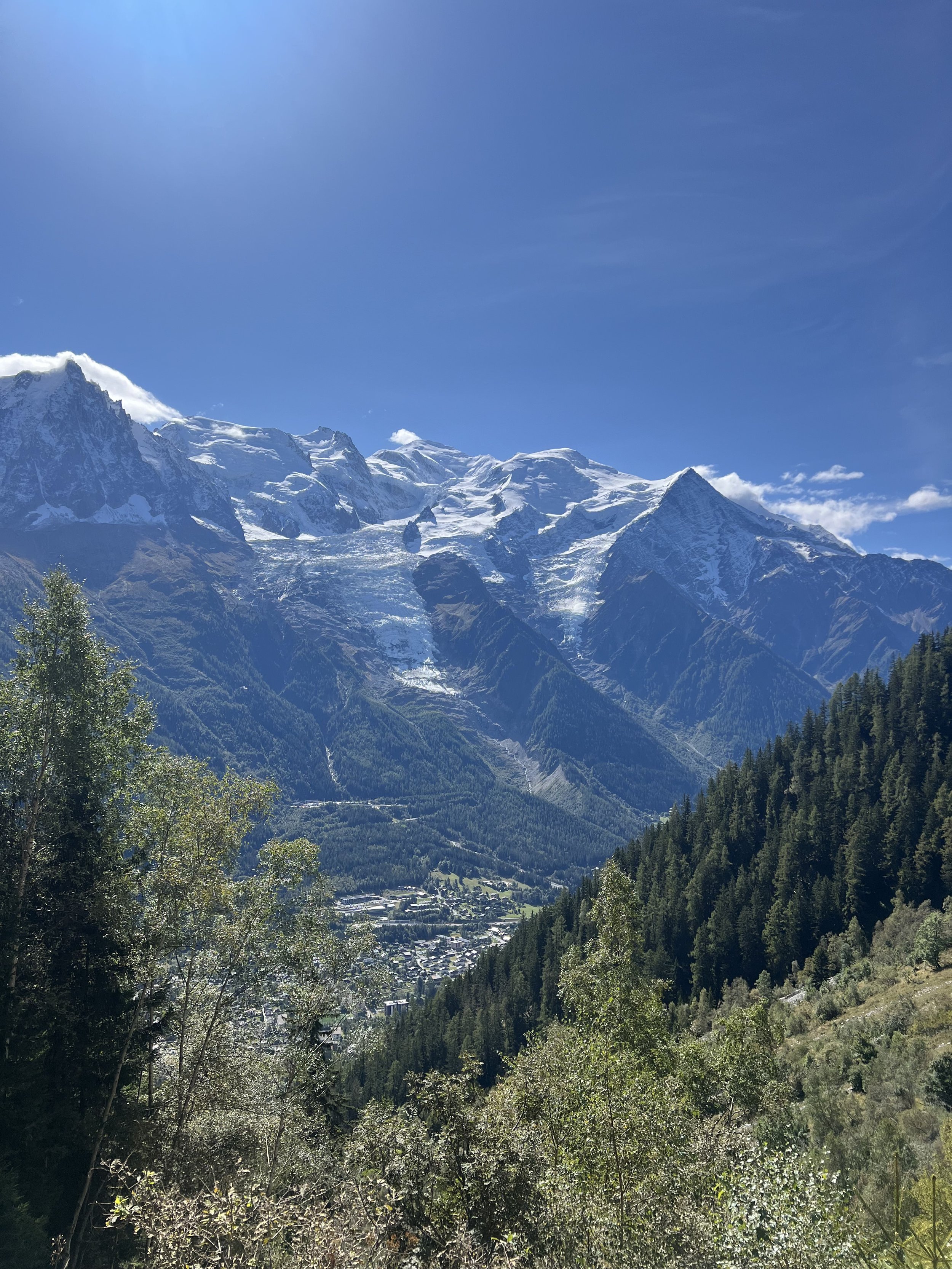
This is one of the best hikes in the French Alps, as you’re treated to unbeatable views of the Mont Blanc massif. The high alpine trail takes you from the foot of the valley up through forests and ridgelines until you reach the stunning Lac Blanc – a mountain lake with incredible panoramic views and water so sparklingly clear you’d be forgiven for thinking you’re looking at a mirror.
The Route: What You Need To Know
Start at Montroc-le-Planet station and follow signs to Col des Montets. The climb begins immediately with steep zigzags and wooden steps.
Continue to Lacs des Chéserys, and watch the views become more dramatic as you climb higher.
Lac Blanc is a popular destination so if you can, arrive early to beat the crowds. And bring plenty of water, as there are no fountains on the route. The restaurant Refuge du Lac Blanc is open from 9:30am to 4:30pm.
From Lac Blanc, descend to La Flégère and take the gondola down to Les Praz (the last gondola leaves around 5pm).
Or, if you want to add on an additional 5km and 200m of elevation, you can continue along the Grand Balcon Sud to Planpraz.

2. Bionnassay and Suspension Bridge Hike
Distance: 8km
Ascent: 582m
Descent: 582m
Highest Point: 1801m
Difficulty: Easy (1/5)
Technicality: Low
Best Time to Go: June to September
Trail Type: 80% forest trail, 10% road, 10% alpine
Country: France
Start point: Bellevue (via tram from Les Houches)
End point: Bellevue (loop route returning to tram station)
Why You’ll Love It
The hike begins with a scenic tram ride up to the Bellevue summit (1801m), where the incredible views and a cooler climate will hit you instantly. From here, the trail follows a section of the Tour du Mont-Blanc, and takes you through forests and across rivers, as well as a jaw-dropping suspension bridge beneath the Bionnassay Glacier. A brief pause for photos is highly recommended at this point.
The Route: What You Need To Know
Start by taking the tram to Bellevue (1801m), where the views will hit you before you’ve even started your hike.
Make a stop off at La Chalette snack bar for homemade pastries and ice cream.
Follow signs for Col de Voza, descending along a jeep track that becomes a quiet road past Le Crozat.
Continue downhill into the village of Bionnassay, then follow a single-track trail across the river via a small footbridge. If you do need to finish early for whatever reason, Bionnassay village is your chance to do so – walk to Bionnay to catch a train back to the valley.
Climb steadily to L’Ormey and follow signs for the Passerelle du Glacier, the aforementioned suspension bridge beneath the Bionnassay glacier.
After crossing, follow the trail uphill across old glacial ridgelines and rocky terrain back toward Bellevue.
Finish at the tramline and return to the valley via the Bellevue lift.
If you want to extend your day, you can add an extra 5km and 300m of climbing with an out-and-back to Col de Tricot (2120m) – just take the trail up at the junction before the suspension bridge.

3. Brévent Day Hike
Distance: 9km
Ascent: 300m
Descent: 1000m (if hiking down to Chamonix)
Highest Point: 2525m
Difficulty: Moderate (2/5)
Technicality: Low to moderate
Best Time to Go: July to September
Trail Type: Rocky alpine trails, forest paths, some steep descents
Country: France
Start point: Brévent Summit (via cable car from Chamonix)
End point: Chamonix (via descent or return cable car)
Why You’ll Love It
For the views you’ll get from this hike, you’d think you have to put in hours of climbing and effort. But this is one of the best day hikes in the French Alps, with world-class views that begin as soon as you step off the cable car at your starting point. If you like a bit of variety on your hikes, then this one will suit you well, with glaciers, peaceful lakes and rugged ridgelines throughout. The Bellachat Refuge is a perfect halfway stop for a snack, with yet more unbelievable views. To get back, you can return via lift or hike back into Chamonix. For this hike, think of exceptional mountain views without overdoing it.
The Route: What You Need To Know
Start by taking the Planpraz gondola from Chamonix to the mid-station at 2000m, then transfer to the Brévent cable car, which ascends to 2525m.
From the summit, follow the marked trail descending toward Lac du Brévent (2125m). The path is rocky and steep in sections, so take care.
After enjoying the peaceful lakeside setting and panoramic views of Mont Blanc, continue along the ridge trail toward the Aiguillette des Houches (2285m), passing through some beautiful alpine meadows (and more views).
En route, consider stopping at the Refuge de Bellachat (2152m) for refreshments and a rest.
To complete the loop, descend through the forested path leading to the Merlet Animal Park, then return to Chamonix via the Petit Balcon Sud trail. Or, for a shorter route, retrace your steps from Lac du Brévent back to the Brévent cable car station and head back down to Chamonix.

4. Petits Balcons
Distance: 21km
Ascent: 711m
Descent: 711m
Highest Point: 1298m
Difficulty: Moderate (2/5)
Technicality: Low to moderate
Best Time to Go: May to October
Trail Type: 100% forest trail
Country: France
Start Point: Église de Chamonix
End Point: Chamonix (loop route)
Why You’ll Love It
If you’re after easy hikes in the French Alps, this should be one to add to your list. It’s a fairly shaded trail route, with gentle undulation and fantastic views. You’ll follow both the Petit Balcon Sud and Petit Balcon Nord trails, which run either side of the Chamonix Valley and give you great views of Mont Blanc and the surrounding peaks. As well as taking in the views on the trails, you’ll pass through charming French villages like Argentière and Les Bois and be able to grab an ice cream or croissant en route.
The Route: What You Need to Know
Start at Église de Chamonix and follow the signs to Petit Balcon Sud.
Follow the trail as it climbs and undulates, eventually descending to Argentière.
Cross to the other side of the valley and follow the signs to Petit Balcon Nord. Enjoy the long, forested return route with views over Chamonix.
Continue straight past the heliport, cross the main road, and finish back in Chamonix.
You can also add on 500m extra and a 90m ascent by detouring to Chalet La Floria for an additional viewpoint and snack stop.

5. Tour du Mont Blanc
Distance: Approximately 170 km
Ascent: ~10,000 m
Descent: ~10,000 m
Highest Point: Col des Fours (2,665 m)
Difficulty: Challenging (4/5)
Technicality: Moderate to high
Best Time to Go: Mid-June to mid-September
Trail Type: Alpine trails, high mountain passes, forest paths, valley crossings
Countries: France, Italy, Switzerland
Start Point: Les Houches, France
End Point: Les Houches, France (loop route)
Why You’ll Love It
The Tour du Mont Blanc (TMB) is one of the most iconic long-distance treks in the world, circling the Mont Blanc massif and taking you through so many different landscapes. Meadows, glacial valleys, high mountain passes and charming villages – this hike covers them all. Covering ground in France, Italy, and Switzerland, the TMB provides a unique hiking or trail running experience, not just for its natural beauty but for its ability to take in multiple countries and terrains all at once. The trails are well-marked and there’s a number of accommodation options en route. This is one for more seasoned hikers who are looking for a multi-day adventure.
The Route: What You Need to Know
Stage 1: Les Houches to Les Contamines (16 km)
Stage 2: Les Contamines to Les Chapieux (18 km)
Stage 3: Les Chapieux to Rifugio Elisabetta (15 km)
Stage 4: Rifugio Elisabetta to Courmayeur (18 km)
Stage 5: Courmayeur to Rifugio Bonatti (12 km)
Stage 6: Rifugio Bonatti to La Fouly (20 km)
Stage 7: La Fouly to Champex (15 km)
Stage 8: Champex to Col de la Forclaz (16 km)
Stage 9: Col de la Forclaz to Tré-le-Champ (13 km)
Stage 10: Tré-le-Champ to La Flégère (8 km)
Stage 11: La Flégère to Les Houches (17 km)
Whether you do the whole route will depend on how fast and experienced you are as a hiker. You can of course opt to do individual stages; you do not need to tick off all eleven consecutively. To fully experience the route, most hikers cover it in 11 days – be sure to plan your itinerary and accommodation in advance as the accommodation options en route get booked up quickly.

6. Aiguille du Midi + Grand Balcon Nord Hike
Distance: 7.2 km
Ascent: 230 m
Descent: 620 m
Highest Point: 2,317 m (Plan de l’Aiguille)
Difficulty: Moderate (2.5/5)
Technicality: Low to moderate
Best Time to Go: Mid-June to September
Trail Type: Alpine balcony trail with rocky sections
Country: France
Start Point: Plan de l’Aiguille (via Aiguille du Midi cable car)
End Point: Montenvers (return to Chamonix via cogwheel train)
Why You’ll Love It
Like all the other hikes we’ve mentioned, this hike does not disappoint when it comes to both high-altitude adventures and views. You start with a cable car ride to the Aiguille du Midi station at 3,842 metres. After taking in the panoramic views of the Mont Blanc massif, you descend slightly by cable car to the Plan de l’Aiguille mid-station and then hike along the Grand Balcon Nord trail, with even more incredible views, this time of the Chamonix valley below. The trail is relatively moderate, but it is exposed so make sure you have adequate SPF and hydration in your bag.
The Route: What You Need to Know
Take the Aiguille du Midi cable car from Chamonix and disembark at the mid-station, Plan de l’Aiguille.
From the station, follow signs for the Grand Balcon Nord trail towards Montenvers.
About halfway along the trail, you have the option to take a brief detour to Signal Forbes (2,198m) for next level views over the Mer de Glace and surrounding peaks.
Continue along the trail, descending gradually to the Montenvers station.
From Montenvers, take the cogwheel train back down to Chamonix.
We suggest starting early so you have ample time for taking in the views, and catching the last train back from Montenvers at 5pm.
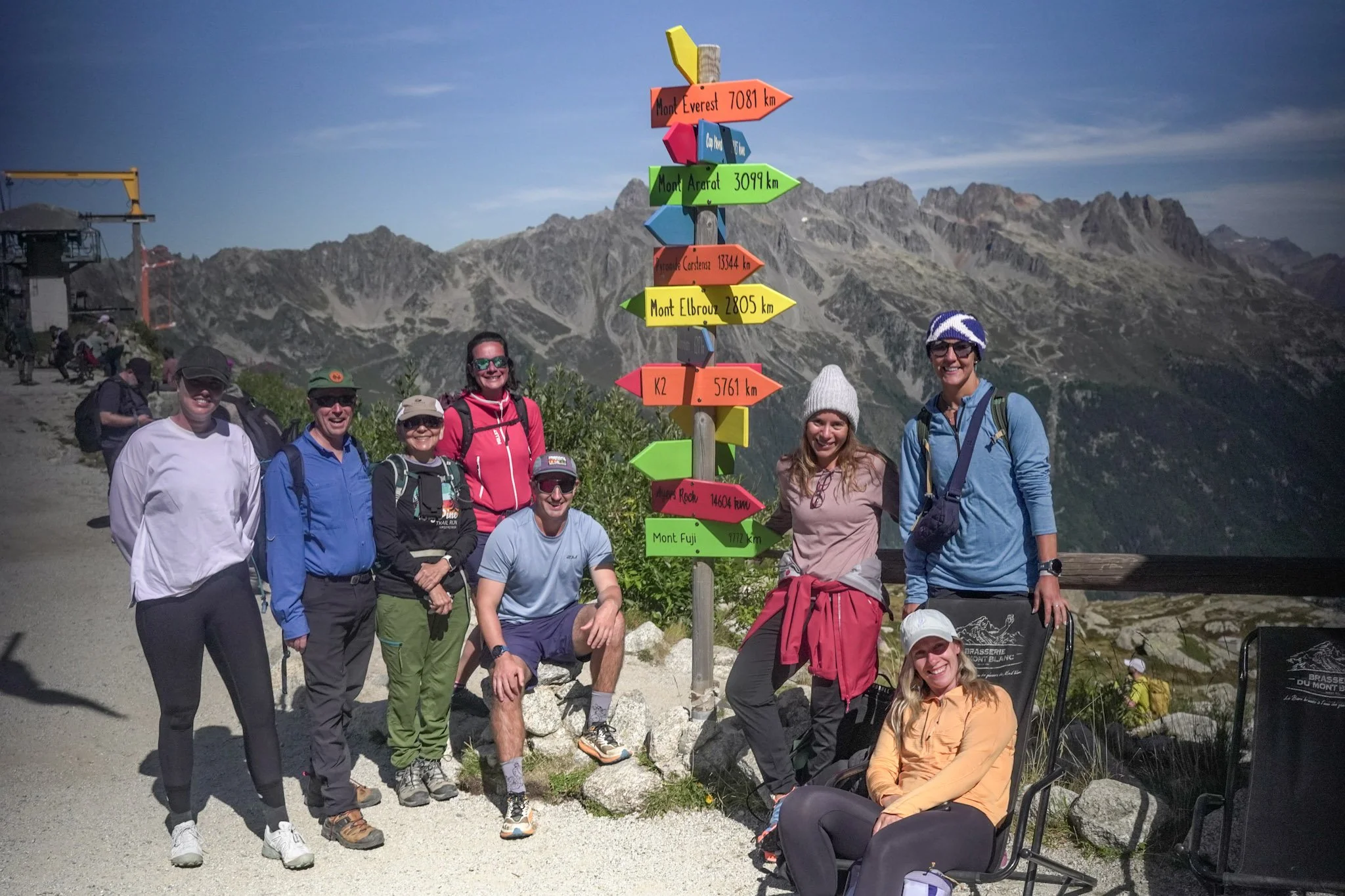
Whether you’re after high-altitude panoramic peaks or gentle forest trails, hiking in the French Alps really does offer an adventure for everyone. There is no greater place to reconnect with nature in its purest form, and it’s understandable why this region has a reputation as one of the best hiking destinations in the world. And whilst some of the hikes might be incredibly challenging, the real challenge lies in deciding which ones to tick off your list first.
Considering Your Own Alpine Adventure?
If hiking in the French Alps is calling your name, why not join us this September for a hiking and yoga retreat in Chamonix? We’ll guide you through some of the region’s most spectacular trails, help you unwind with daily yoga, and give you time to enjoy all that mountain life has to offer. For new and seasoned hikers alike, this is your invitation to experience the magic of the Alps with a group of like-minded individuals. Find out more here.
RELATED BLOGS


Want more articles like this?
Sign up and be the first to receive news and updates!